Next-generation mapping
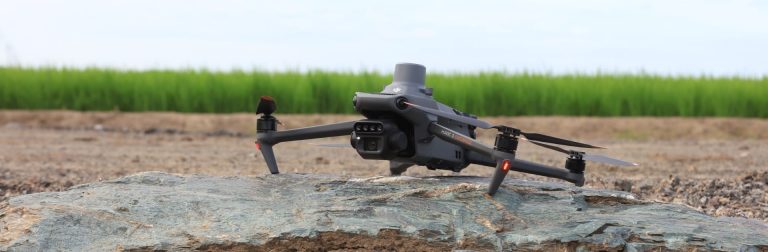
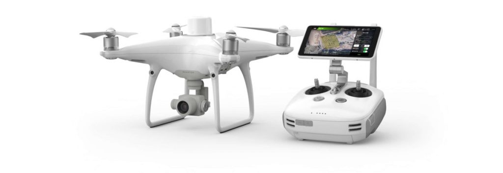
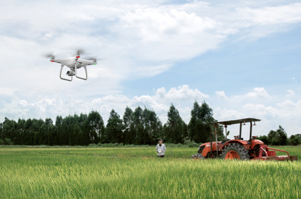
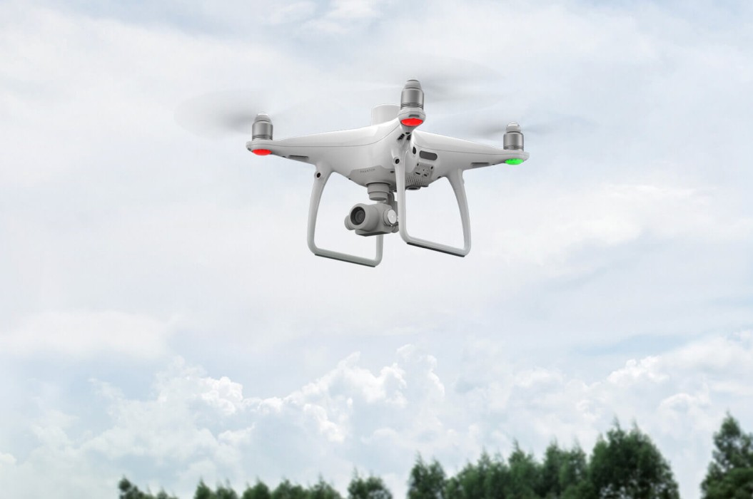
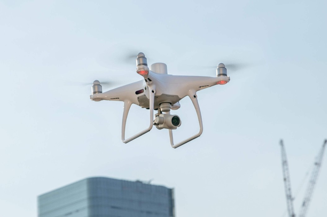
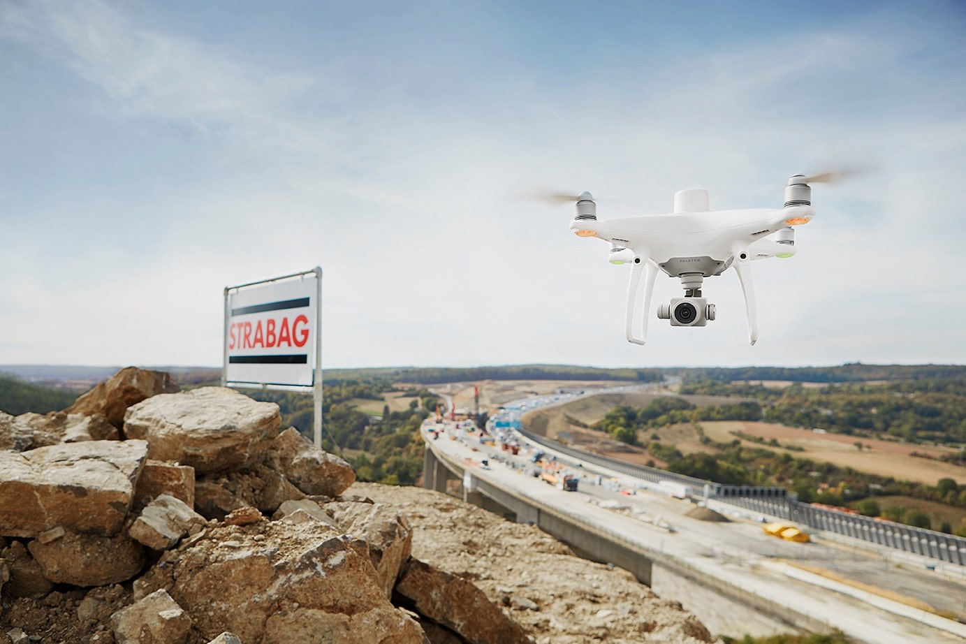
DJI Phantom 4 RTK mapping drone
DJI has rethought its drone technology from the ground-up, revolutionizing its systems to achieve a new standard for drone accuracy—offering Phantom 4 RTK customers centimeter-accurate data while requiring fewer ground control points.
1cm+1ppm
RTK Horizontal
Positioning Accuracy
1,5cm+1ppm
RTK Vertical
Positioning Accuracy
5cm*
Absolute Horizontal Accuracy of Photogrammetric Models
RTK Module
1" CMOS Sensor
TimeSync
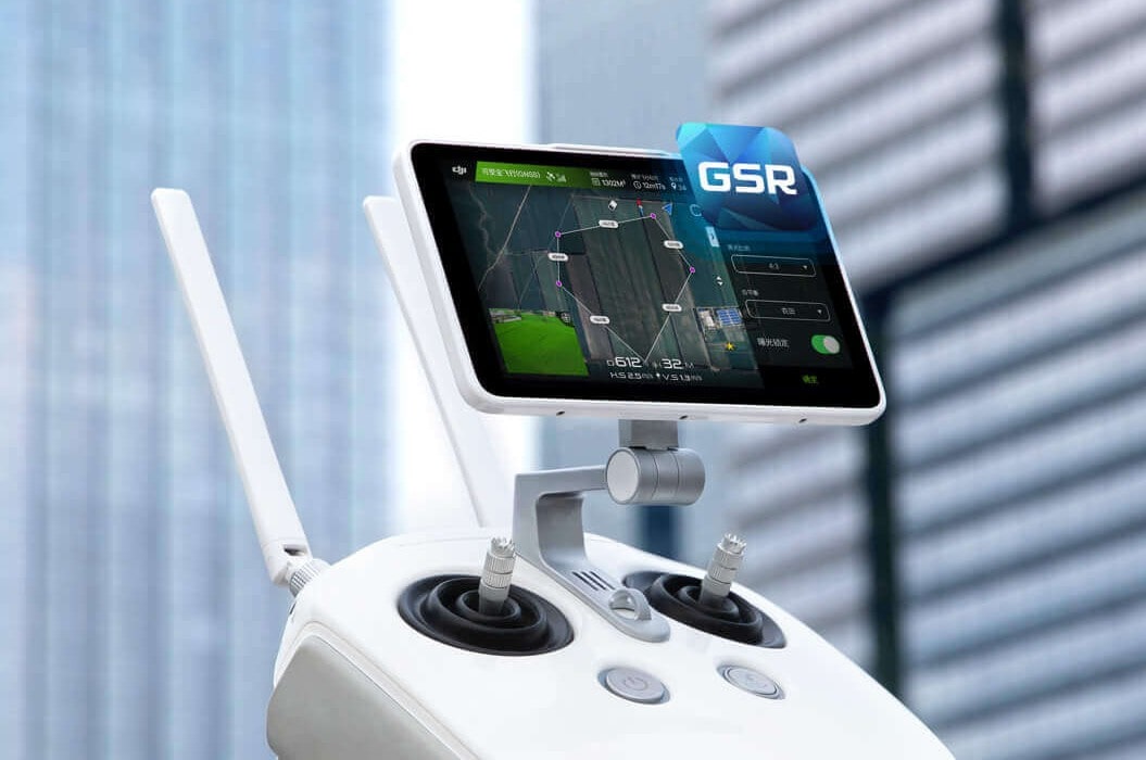
GS RTK Application
OcuSync
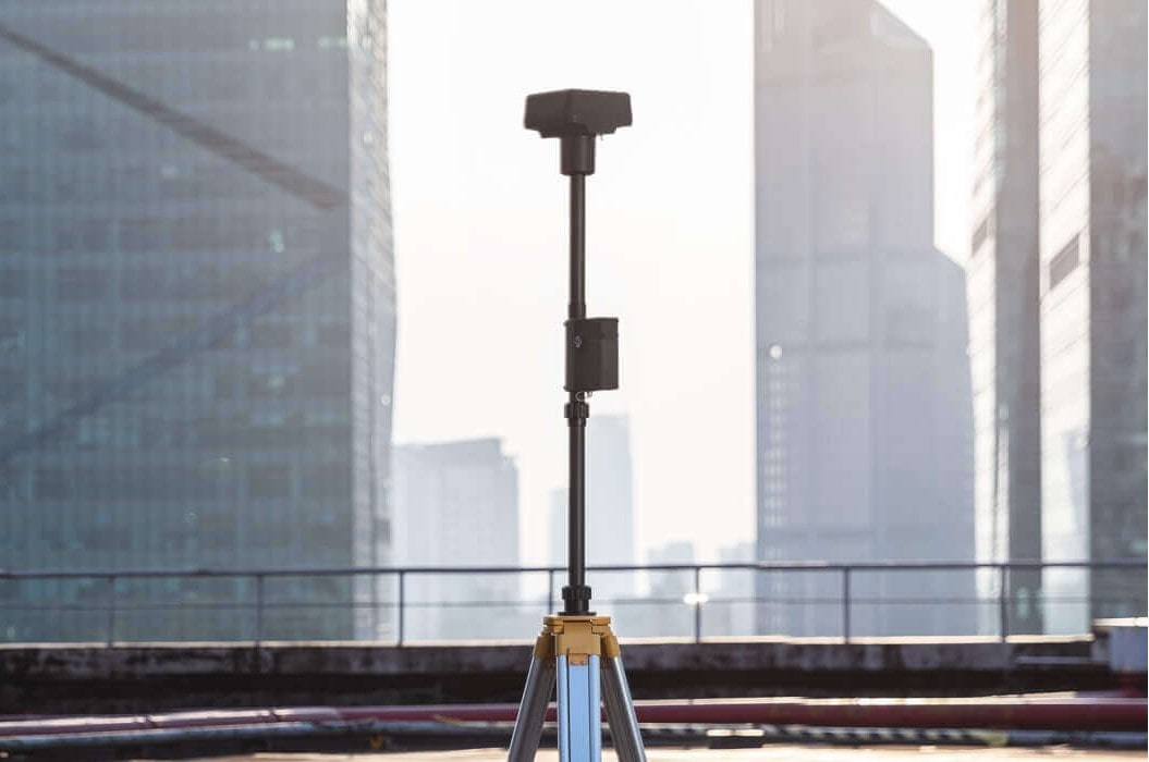
D-RTK 2 Mobile Station
*when flying in sunny conditions, wind speeds below 4m/s, 100m height and 2.74cm GSD, front overlap rate of 80%, side overlap rate of 70%
Why choose the DJI Phantom 4 RTK mapping and monitoring drone?
DJI Phantom 4 RTK drone
Benefits and features
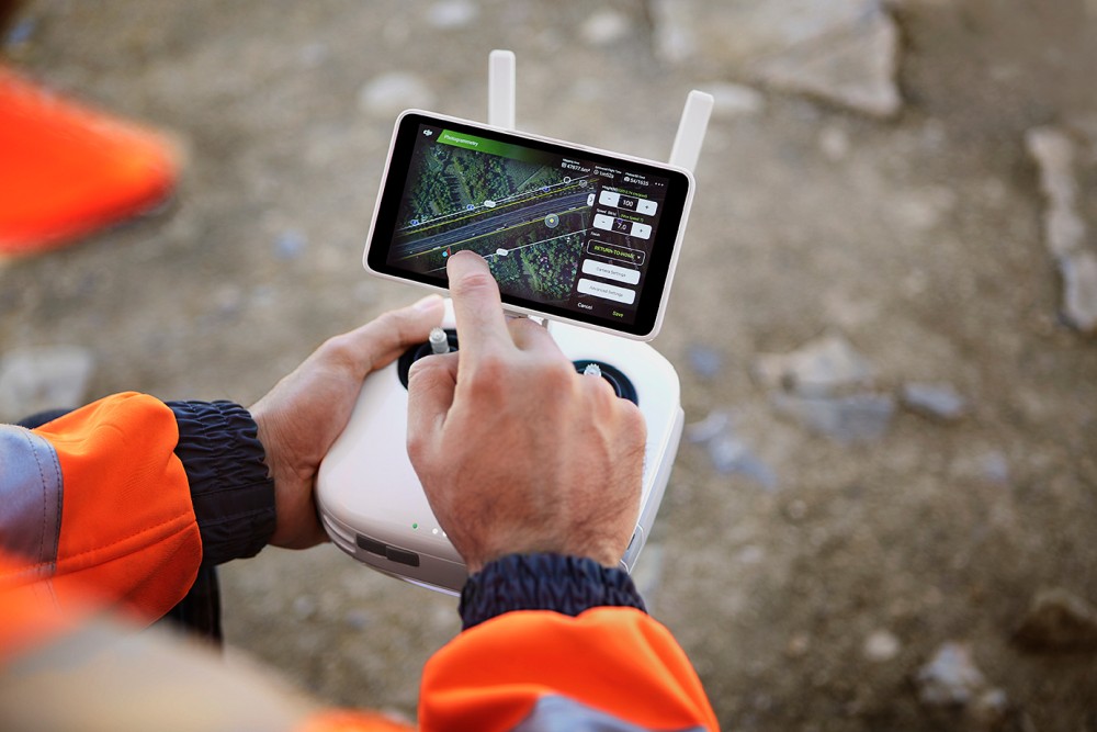
Simple flight planning and intelligent design
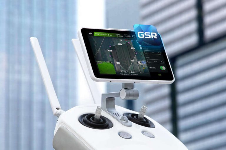
- GS RTK application designed specifically for the drone
- Easy to use; handling it can be learned in a few minutes
- Two planning modes: photogrammetric and designated-route flight
- A wide range of settings: you can specify the ratio of overlaps, the height, and the parameters and speed of taking photos
- Insert KML/KMZ files into the application to optimize your assessment
- DJI Mobile SDK support for third-party applications and to create personalized automated features
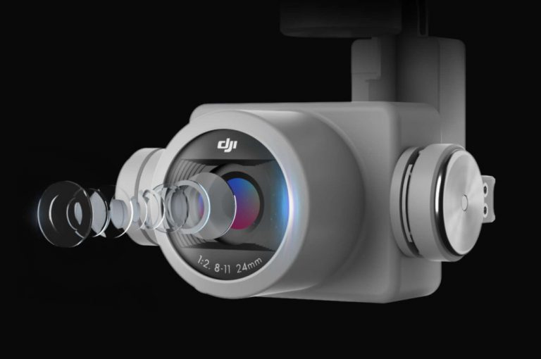
High-quality and accurate imaging system
- Standard 1" CMOS sensor
- Mechanical shutter for blur-free photos
- The lenses undergo a rigorous calibration process for unparalleled accuracy
- 2.74cm per-pixel accuracy at 100 meters’ flight altitude
- Parameters can be saved in image metadata, facilitating software-based post-processing
- Detailed ISO setup options (video: 100-3200 (Auto), 100-6400 (Manual), photo: 100-3200 (Auto), 100-12800 (Manual)
- Maximum image resolution: 4864×3648 (4:3) / 5472×3648 (3:2)
- Maximum video resolution: 4K 3840×2160 (30fps, H.264)
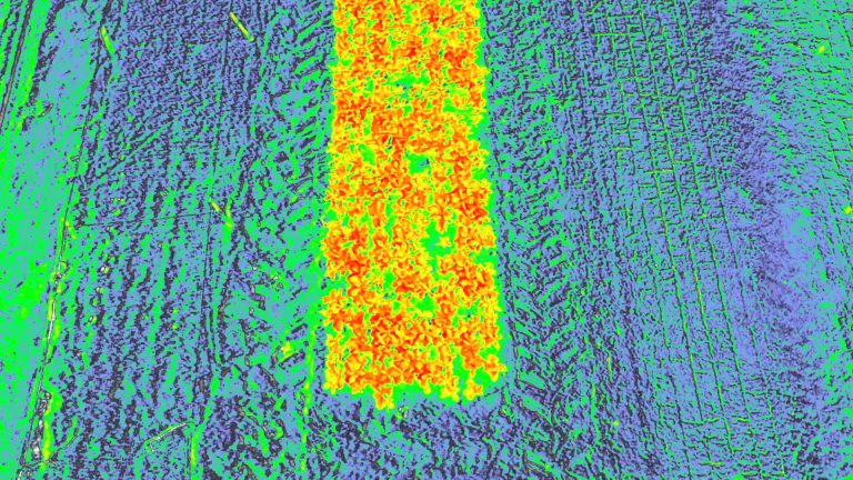
High-precision aerial photography and 3D maps
- RTK module integrated directly into the drone
- Real-time, centimeter-level positioning data (1cm + 1ppm horizontally and 1.5cm + 1ppm vertically) is added to the image metadata
- GNSS module to maintain flight stability in the event of weak signal strength (e.g. densely populated cities)
- RTK + GNSS = better flight safety and more accurate data for complex assessment, mapping and verification workflows
- TimeSync system – continuous synchronization of flight control, camera and RTK module for greater accuracy
- D-RTK 2 Mobile station support to improve survey accuracy through real-time signal correction
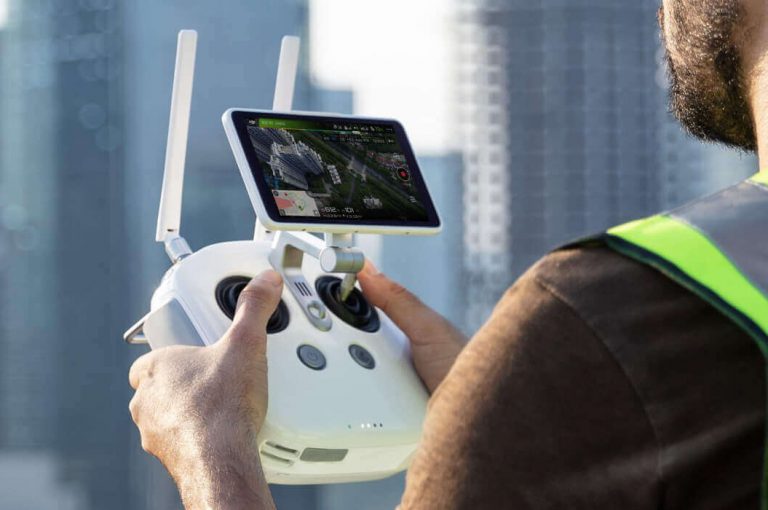
Enhanced multifunction controller
- Enhanced Phantom 4-series controller with 5.5” ultra-light HD display
- MicroSD card support for storing post-processing survey data
- Support for 4G Dongle to synchronize RTK positioning data over the Internet
- The GS RTK application enables easy and smart control with various planning modes
- DJI OcuSync for low-latency video transmission at a maximum distance of 7 kilometers (available maximum distance is region-specific)
- Controller designed to fly multiple drones (up to 5)
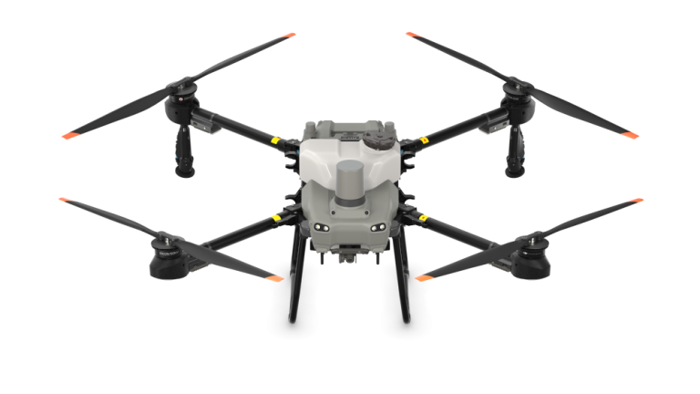
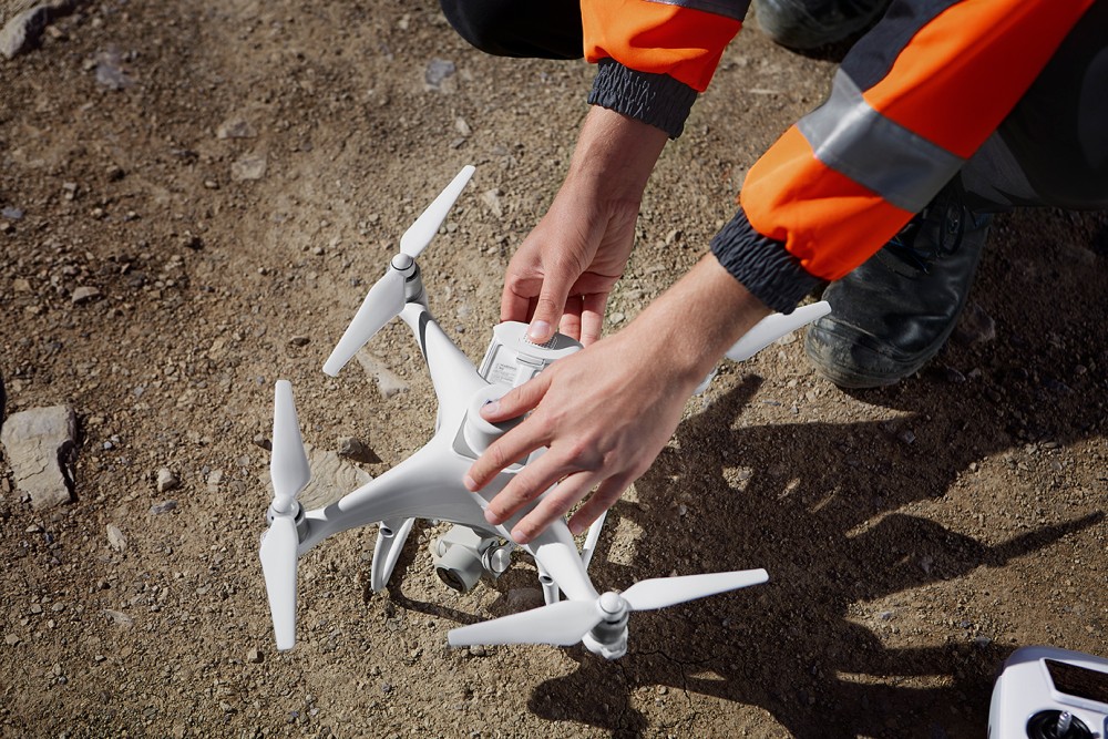
DJI Phantom 4 RTK drone and its accessories
DJI Phantom 4 RTK drone prices
Thanks to the DJI Phantom 4 RTK built-in flight planner application (GS RTK) and the high-precision RTK data collection methods (RTK or even D-RTK 2 Mobile Station), pilots gain a complete solution for any survey, mapping or test session—right out of the box.

DJI Phantom 4 RTK images and videos
Learn more about the DJI Phantom 4 RTK drone


More you might be interested in about the DJI Phantom 4 RTK drone
DJI Phantom 4 RTK – Featured specifications
| AIRCRAFT | |
|---|---|
| Takeoff Weight | 1391 g |
| Diagonal Distance | 350 mm |
| Max Service Ceiling Above Sea Level | 19685 ft (6000 m) |
| Max Ascent Speed | 6 m/s (automatic flight); 5 m/s (manual control) |
| Max Descent Speed | 3 m/s |
| Max Speed | 31 mph (50 kph)(P-mode), 36 mph (58 kph)(A-mode) |
| Max Flight Time | Approx. 30 minutes |
| Operating Temperature Range | 32° to 104° F (0° to 40℃) |
| Operating Frequency | 2.400 GHz to 2.483 GHz (Europe, Japan, Korea), 5.725 GHz to 5.850 GHz (United States, China) |
| Transmission Power (EIRP) | 2.4 GHz - CE (Europe) / MIC (Japan) / KCC (Korea) :< 20 dBm, 5.8 GHz - SRRC(China) / FCC(United States / NCC(Taiwan,China): < 26 dBm |
| Hover Accuracy Range | RTK enabled and functioning properly:Vertical:±0.1 m;Horizontal:±0.1 m; RTK disabled. Vertical:±0.1 m(with vision positioning );±0.5 m(with GNSS positioning)Horizontal:±0.3 m(with vision positioning); ±1.5 m(with GNSS positioning) |
| Image Position Offset | The position of the camera center is relative to the phase center of the onboard D-RTK antenna under the aircraft body's axis:(36, 0, and 192 mm) already applied to the image coordinates in Exif data. The positive x, y, and z axes of the aircraft body point to the forward, rightward, and downward of the aircraft, respectively. |
| MAPPING FUNCTIONS | |
| Mapping Accuracy | Mapping accuracy meets the requirements of the ASPRS Accuracy Standards for Digital Orthophotos Class Ⅲ ** The actual accuracy depends on surrounding lighting and patterns, aircraft altitude, mapping software used, and other factors when shooting. |
| Ground Sample Distance(GSD) | (H/36.5) cm/pixel,H means the aircraft altitude relative to shooting scene (unit: m) |
| Data Acquisition Efficiency | Max operating area of approx. 1 km² for a single flight(at an altitude of 182 m, i.e., GSD is approx. 5 cm/pixel, meeting the requirements of the ASPRS Accuracy Standards for Digital Orthophotos Class Ⅲ |
| VISION SYSTEM | |
| Velocity Range | ≤31 mph(50 kph) at 6.6 ft(2 m) above ground with adequate lighting |
| Altitude Range | 0-33 ft(0 - 10 m) |
| Operating Range | 0-33 ft(0 - 10 m) |
| Obstacle Sensing Range | 2-98 ft(0.7-30 m) |
| FOV | Forward/Rear: 60° (horizontal), ±27° (vertical), Downward: 70° (front and rear), 50° (left and right) |
| Measuring Frequency | Forward/Rear:10 Hz; Downward: 20 Hz |
| Operating Environment | Surfaces with clear patterns and adequate lighting(> 15 lux) |
| CAMERA | |
| Sensor | 1" CMOS; Effective pixels: 20 M |
| Lens | FOV 84°;8.8 mm / 24 mm(35 mm format equivalent:24 mm);f/2.8 - f/11, auto focus at 1 m - ∞ |
| ISO Range | Video:100-3200(Auto) 100-6400(Manual);Photo:100-3200(Auto) 100-12800(Manual) |
| Mechanical Shutter Speed | 8 - 1/2000 s |
| Electronic Shutter Speed | 8 - 1/8000 s |
| Max Image Size | 4864×3648(4:3);5472×3648(3:2) |
| Video Recording Modes | H.264,4K:3840×2160 30p |
| Photo Format | JPEG |
| Video Format | MOV |
| Supported File Systems | FAT32(≤ 32 GB);exFAT(> 32 GB) |
| Supported SD Cards | MicroSD, Max Capacity: 128 GB. Class 10 or UHS-1 rating required Write speed≥15 MB/s |
| Operating Temperature Range | 32° to 104° F (0° to 40℃) |
| Capacity | 5870 mAh |
| Voltage | 15.2 V |
| Battery Type | LiPo 4S |
| Energy | 89.2 Wh |
| Net Weight | 468 g |
| Charging Temperature Range | 14° to 104℉(-10° to 40℃) |
| Max charging Power | 160 W |
| Input Voltage | 17.3 - 26.2 V |
| Output Voltage and Current | 8.7 V,6 A;5 V,2 A |
| Operating Temperature | 41° to 104℉(5° to 40℃) |
| SDK REMOTE CONTROLLER | |
| Operating Frequency | 2.400 GHz to 2.483 GHz (Europe, Japan, Korea) 5.725 GHz to 5.850 GHz (Other countries/regions) |
| EIRP | 2.4 GHz CE / MIC / KCC: < 20 dBm; 5.8 GHz FCC / SRRC / NCC: < 26 dBm |
| Max Transmission Distance | FCC / NCC: 4.3 mi (7 km); CE / MIC / KCC / SRRC: 3.1 mi (5 km) (Unobstructed, free of interference) |
| Built-in Battery | 6000 mAh LiPo 2S |
| Operating Current / Voltage | 1.2 A @ 7.4 V |
| Mobile Device Holder | Tablets and smartphones |
| Operating Temperature | 32° to 104° F (0° to 40° C) |
| GNSS | |
| Single-Frequency, High-Sensitivity GNSS Module | GPS+BeiDou+Galileo(Asia); GPS+GLONASS+Galileo(other regions) |
| Multi-Frequency Multi-System High-Precision RTK GNSS | Frequency Used:GPS:L1/L2;GLONASS:L1/L2;BeiDou:B1/B2;Galileo:E1/E5a; First-Fixed Time:< 50 s; Positioning Accuracy: Vertical 1.5 cm + 1 ppm(RMS);Horizontal 1 cm + 1 ppm(RMS)1 ppm means the error has a 1mm increase for every 1 km of movement from the aircraft. |
| GIMBAL | |
| Stabilization | 3-axis (tilt, roll, yaw) |
| Pitch | -90° to +30° |
| Max Controllable Angular Speed | 90°/s |
| Angular Vibration Range | ±0.02° |
| INFRARED | |
| Obstacle Sensing Range | 0.6-23 ft(0.2 - 7 m) |
| FOV | 70°(Horizontal); ±10°(Vertical) |
| Measuring Frequency | 10 Hz |
| Operating Environment | Surface with diffuse reflection material, and reflectivity> 8%(such as wall,trees, humans, etc.) |
| REMOTE CONTROLLER | |
| Operating Frequency | 2.400 GHz-2.483 GHz(Europe,Japan,Korea); 5.725 GHz-5.850 GHz(United States, China) |
| Transmission Power (EIRP) | 2.4 GHz CE / MIC / KCC:< 20 dBm; 5.8 GHz SRRC / FCC:< 26 dBm |
| Max Transmission Distance | FCC:4.3 mi(7 km);SRRC / CE / MIC / KCC:3.1 mi(5 km) (Unobstrcted, free of interference) |
| Power Consumption | 16 W(typical value) |
| Display | 5.5 inch screen, 1920×1080, 1000 cd/m², Android System; Memory 4G RAM+16G ROM |
| Operating Temperature Range | 32° to 104° F (0° to 40℃) |
| INTELLIGENT FLIGHT BATTERY CHARGING HUB (P4 CHARGING HUB) | |
| Voltage | 17.5 V |
| Operating Temperature Range | 41° to 104℉(5° to 40℃) |
| Capacity | 4920 mAh |
| Voltage | 7.6 V |
| Battery Type | LiPo 2S |
| Energy | 37.39 Wh |
| Operating Temperature | -4° to 104℉(-20° to 40℃) |
| AC POWER ADAPTER (PH4C160) | |
| Voltage | 17.4 V |
| Rated Power | 160 W |