Next-generation phytosanitary assessments
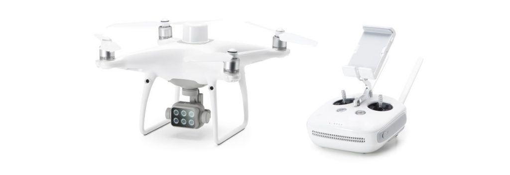
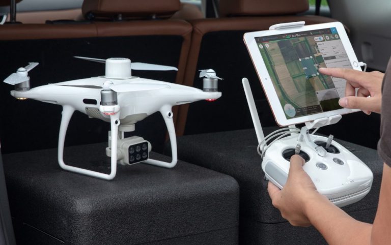
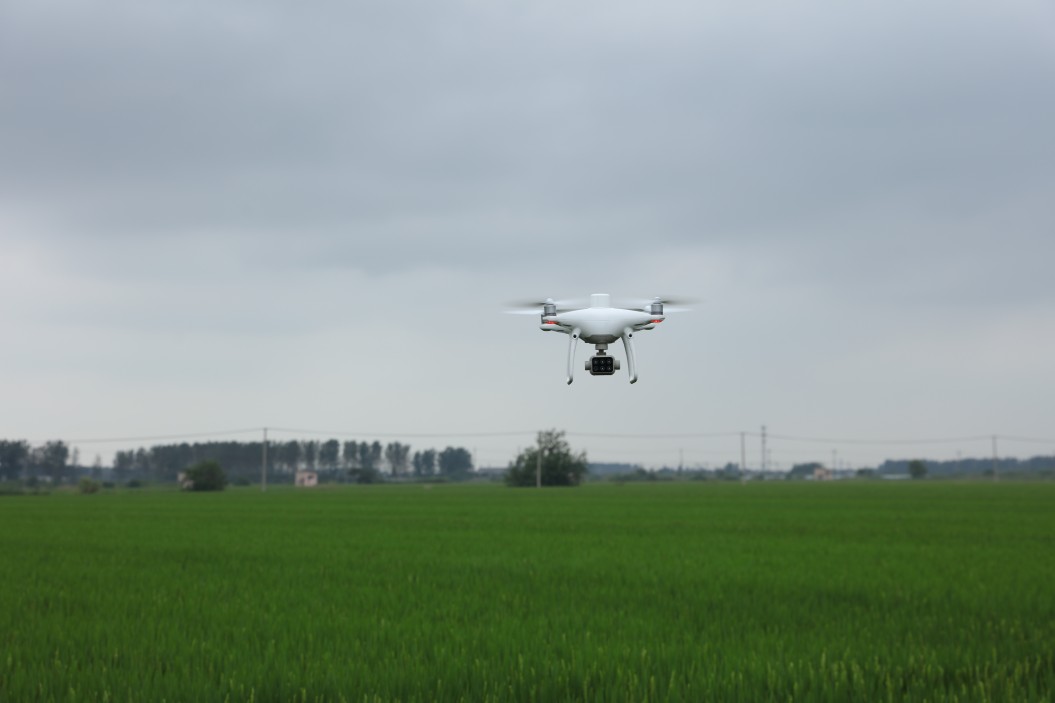
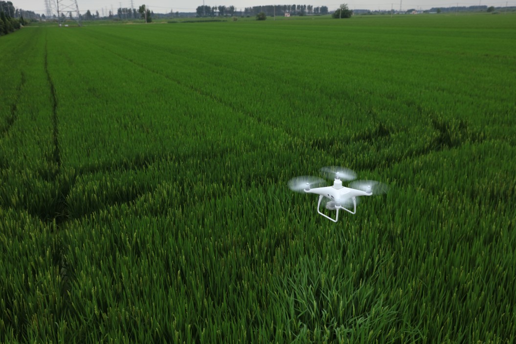
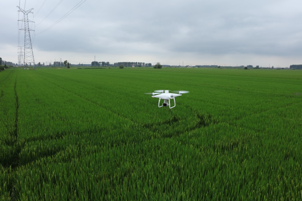
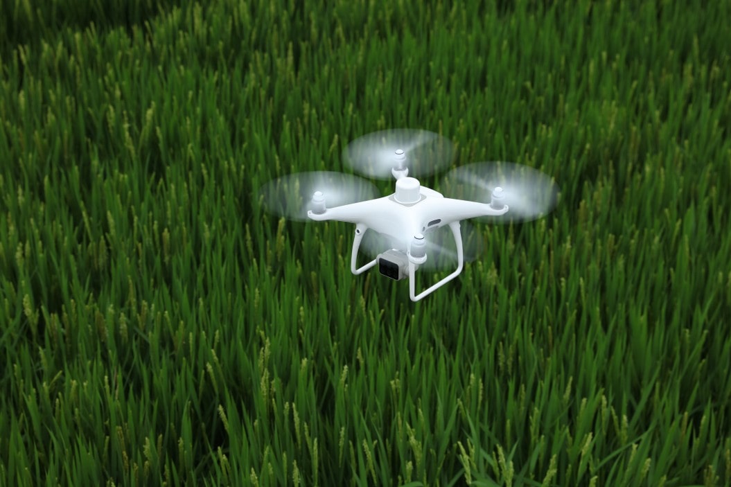
DJI P4 Multispectral mapping drone
Gather precise plant-level data using the DJI P4 Multispectral—a high-precision drone with a seamlessly integrated multispectral imaging system built for agricultural tasks, environmental monitoring and much more.
Multispectral Imaging System
Live NDVI View
RTK Module
DJI TimeSync
Why choose the DJI P4 Multispectral mapping and monitoring drone?
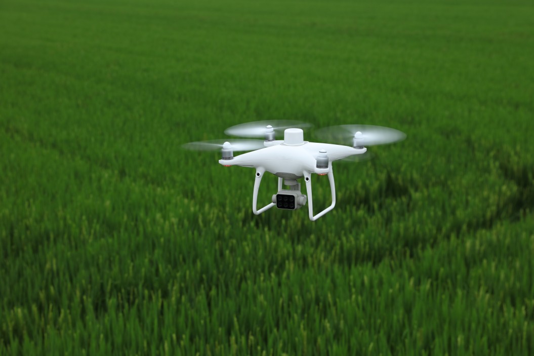
DJI P4 Multispectral drone
Benefits and features
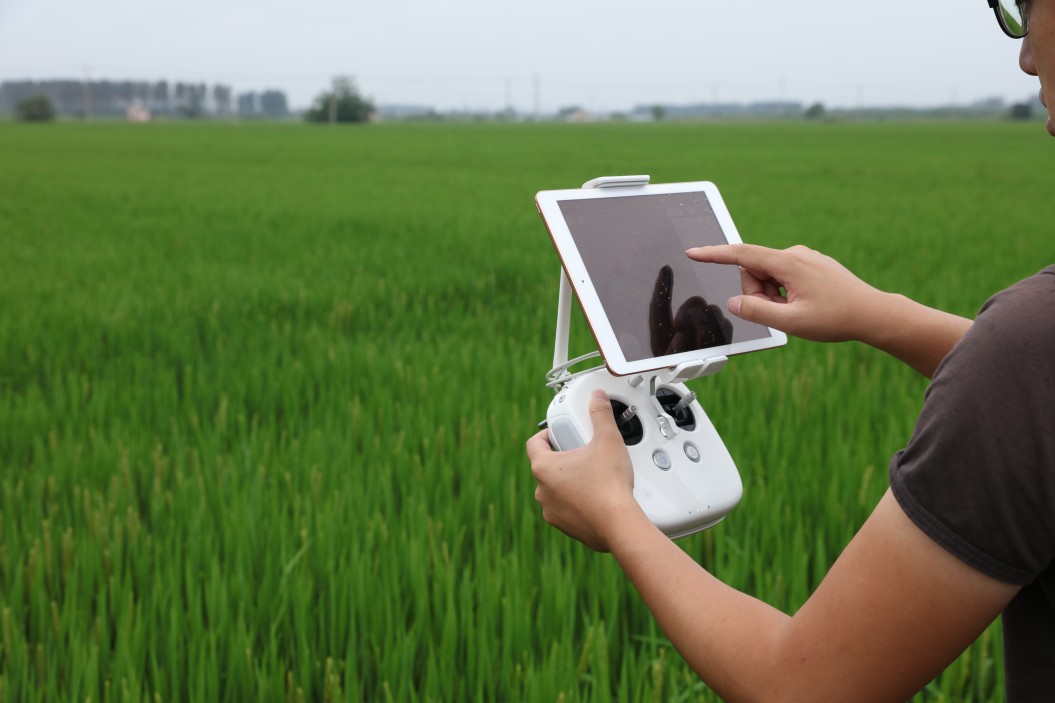
Simple flight planning and more consistent workflows
- Easy to use; handling it can be learned in a few minutes
- Enhanced Phantom 4-series SDK control unit to connect your own iOS device
- DJI GS Pro application designed specifically for the drone
- The DJI GS Pro application enables you to create automated and repeatable tasks, including flight planning, mission execution and flight data management
- Switch immediately between the real-time view of the drone’s RGB video camera and the NDVI (Normalized Difference Vegetation Index) output to get instant visibility right on the spot
- DJI OcuSync for low-latency video transmission at a maximum distance of 7 kilometers (available maximum distance is region-specific)
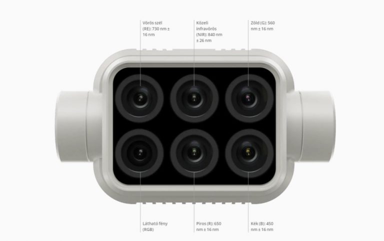
Accurate multispectral imaging
- The built-in stabilized imaging system collects comprehensive data sets
- The system consists of 1 RGB camera and a 5-camera multispectral system
- Collecting data invisible to the human eye and making them understandable: it covers blue, green, red, bright red and near-infrared ranges—2 MP resolution with a 3-axis stabilizer
- The integrated spectral sunlight sensor at the top captures sunlight, maximizing accuracy and consistency of data collection at different times of the day
- The lenses undergo a rigorous calibration process for unparalleled accuracy
- Parameters are saved in the image metadata to facilitate software-based post-processing
High-precision aerial photography
- RTK module integrated directly into the drone
- Real-time, centimeter-level positioning data is added to the image metadata
- GNSS module to maintain flight stability in the event of weak signal strength (e.g. densely populated cities)
- RTK + GNSS = better flight safety and more accurate data for complex assessment, mapping and verification workflows
- TimeSync system – continuous synchronization of flight control, camera and RTK module for greater accuracy
- D-RTK 2 Mobile station support to improve survey accuracy through real-time signal correction
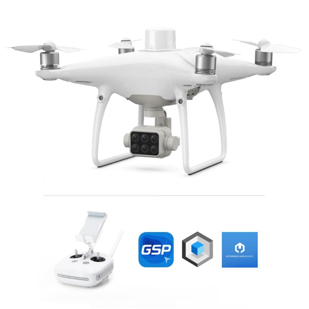
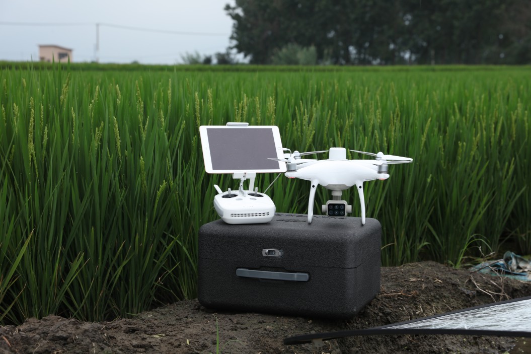
DJI P4 Multispectral drone and its accessories
DJI P4 Multispectral drone – Prices
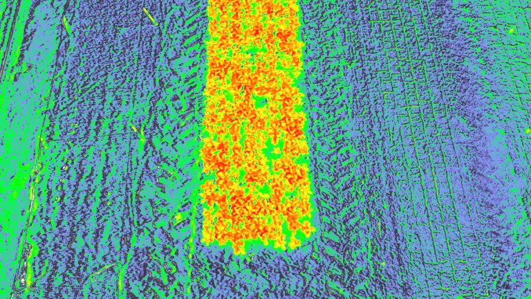
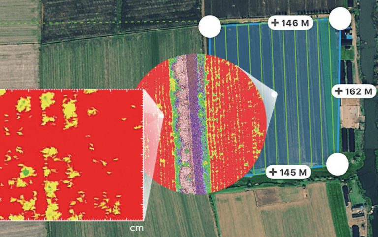
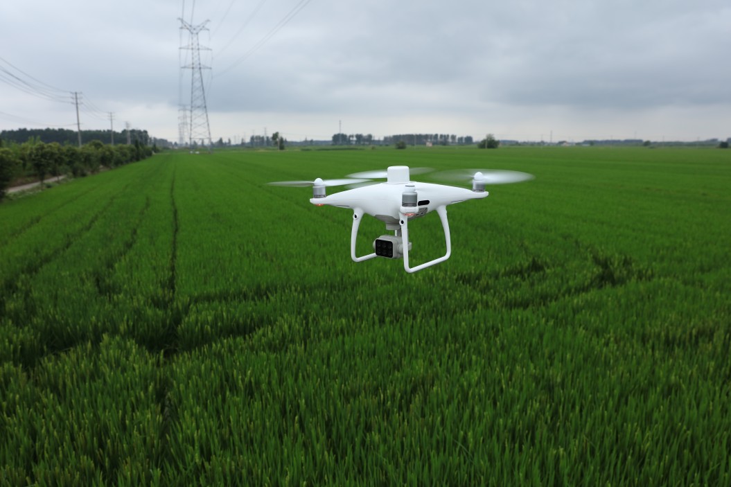
The DJI P4 Multispectral drone can help agricultural professionals at any time of the year by providing information that’s invisible to the naked eye. With the vegetation index data derived from this (such as NDRE and NDVI), farmers can make informed, up-to-date decisions to manage crops more efficiently, reduce costs, save resources, and maximize yields.
DJI P4 Multispectral
Shield Combo
- DJI P4 MS drone and its accessories
- 1 year DJI GS Pro (Team-Professional) software license
- 1 year DJI Terra Basic software license
- 1 year Enterprise Shield Basic Warranty Service
DJI P4 Multispectral images and videos
Learn more about the DJI P4 Multispectral drone


More you might be interested in about the DJI P4 Multispectral drone
DJI P4 Multispectral – Featured specifications
| AIRCRAFT | |
|---|---|
| Takeoff Weight | 1487 g |
| Diagonal Distance | 350 mm |
| Max Service Ceiling Above Sea Level | 19685 ft (6000 m) |
| Max Ascent Speed | 6 m/s (automatic flight); 5 m/s (manual control) |
| Max Descent Speed | 3 m/s |
| Max Speed | 31 mph (50 kph)(P-mode); 36 mph (58 kph)(A-mode) |
| Max Flight Time | Approx. 27 minutes |
| Operating Temperature Range | 32° to 104° F (0° to 40℃) |
| Operating Frequency | 2.400 GHz to 2.483 GHz (Europe, Japan, Korea); 5.725 GHz to 5.850 GHz (United States, China) |
| Transmission Power (EIRP) | 2.4 GHz - CE (Europe) / MIC (Japan) / KCC (Korea) :< 20 dBm; 5.8 GHz - SRRC(China) / FCC(United States / NCC(Taiwan,China): < 26 dBm |
| Hover Accuracy Range | RTK enabled and functioning properly:Vertical:±0.1 m;Horizontal:±0.1 m; RTK disabled Vertical:±0.1 m(with vision positioning );±0.5 m(with GNSS positioning) Horizontal:±0.3 m(with vision positioning); ±1.5 m(with GNSS positioning) |
| Image Position Offset | The relative positions of the centers of the six cameras’ CMOS and the phase center of the onboard D-RTK antenna have been calibrated and are recorded in the EXIF data of each image. |
| MAPPING FUNCTIONS | |
| Ground Sample Distance(GSD) | (H/18.9) cm/pixel, H indicates the aircraft altitude relative to the area mapped (unit: m) |
| Data Acquisition Efficiency | Max operating area of approx. 0.63 km2 for a single flight at an altitude of 180 m, i.e., GSD is approx. 9.52 cm/pixel, with a forward overlap rate of 80% and a side overlap ratio of 60%, during a flight that drains the battery from 100% to 30%. |
| VISION SYSTEM | |
| Velocity Range | ≤31 mph(50 kph) at 6.6 ft(2 m) above ground with adequate lighting |
| Altitude Range | 0-33 ft(0 - 10 m) |
| Operating Range | 0-33 ft(0 - 10 m) |
| Obstacle Sensing Range | 2-98 ft(0.7-30 m) |
| Operating Environment | Surfaces with clear patterns and adequate lighting(> 15 lux) |
| CAMERA | |
| Sensor | Six 1/2.9” CMOS, including one RGB sensor for visible light imaging and five monochrome sensors for multispectral imaging. Each Sensor: Effective pixels 2.08 MP (2.12 MP in total) |
| Filters | Blue (B): 450 nm ± 16 nm; Green (G): 560 nm ± 16 nm; Red (R): 650 nm ± 16 nm; Red edge (RE): 730 nm ± 16 nm; Near-infrared (NIR): 840 nm ± 26 nm |
| Lens | FOV (Field of View): 62.7°; Focal Length: 5.74 mm (35 mm format equivalent: 40 mm), autofocus set at ∞; Aperture: f/2.2 |
| RGB Sensor ISO Range | 200 - 800 |
| Monochrome Sensor Gain | 1 - 8x |
| Electronic Shutter Speed | Electronic Global Shutter; 1/100 - 1/20000 s (visible light imaging); 1/100 - 1/10000 s (multispectral imaging) |
| Max Image Size | 1600×1300 (4:3.25) |
| Photo Format | JPEG (visible light imaging) + TIFF (multispectral imaging) |
| Supported File Systems | FAT32(≤ 32 GB);exFAT(> 32 GB) |
| Supported SD Cards | MicroSD, Max Capacity: 128 GB. Class 10 or UHS-1 rating required Write speed≥15 MB/s |
| Operating Temperature Range | 32° to 104° F (0° to 40℃) |
| Capacity | 5870 mAh |
| Voltage | 15.2 V |
| Battery Type | LiPo 4S |
| Energy | 89.2 Wh |
| Net Weight | 468 g |
| Charging Temperature Range | 14° to 104℉(-10° to 40℃) |
| Max charging Power | 160 W |
| GNSS | |
| Single-Frequency, High-Sensitivity GNSS Module | GPS+BeiDou+Galileo(Asia);GPS+GLONASS+Galileo(other regions) |
| Multi-Frequency Multi-System High-Precision RTK GNSS | Frequency Used GPS: L1/L2; GLONASS: L1/L2; BeiDou: B1/B2; Galileo[2]: E1/E5; First-Fixed Time: < 50 s; Positioning Accuracy: Vertical 1.5 cm + 1 ppm (RMS); Horizontal 1 cm + 1 ppm (RMS). 1 ppm indicates error with a 1 mm increase over 1 km of movement. Velocity Accuracy: 0.03 m/s |
| GIMBAL | |
| Pitch | Tilt: -90° to +30° |
| REMOTE CONTROLLER | |
| Operating Frequency | 2.400 GHz-2.483 GHz(Europe,Japan,Korea); 5.725 GHz-5.850 GHz(United States, China) |
| Transmission Power (EIRP) | 2.4 GHz CE / MIC / KCC:< 20 dBm; 5.8 GHz SRRC / FCC:< 26 dBm |
| Max Transmission Distance | FCC:4.3 mi(7 km);SRRC / CE / MIC / KCC:3.1 mi(5 km) (Unobstrcted, free of interference) |
| Power Consumption | 16 W(typical value) |
| Display | 5.5 inch screen, 1920×1080, 1000 cd/m², Android System; Memory 4G RAM+16G ROM |
| Built-in Battery | 6000 mAh LiPo 2S |
| Operating Current / Voltage | 1.2 A @ 7.4 V |